new & updated
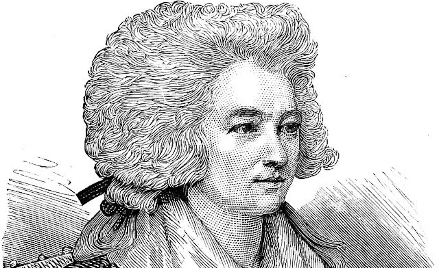
Hannah More: Sunday schools and education, writing and literacy, ending slavery and setting the scene for youth work. Hannah More was initially famous for her playwriting and involvement in ‘blue stocking’ circles. Later, her evangelicalism led her to philanthropy, writing popular religious tracts and pioneering work around Sunday schools and the end of slavery. Here, we examine these achievements and her contribution to the development of work with young people. (Major update: July 2026)
What is informal education? This piece explores its nature, practice and purpose. Informal education is approached as a spontaneous process of helping people to learn. It works through conversation and the exploration and enlargement of experience. The purpose is to cultivate communities, associations and relationships that make for human flourishing. [Updated April 2026]
Josephine Klein, group work, youth work and exploring English cultures. Klein’s Commandos – A Personal View. Josephine Klein was one of the first British-based practitioners to explore group processes and to work systematically with groups. She also completed a landmark study of family and community life and developed a distinctive approach to training in youth and community work before becoming a psychotherapist. Don Macdonald reflects on Josephine Klein’s major contribution. (First published February 2026).
Walking informal education – exploring developments in central London. Walking in central London, we can find many places associated with key figures and moments in the making of informal education. Explore them through a virtual (or real) walk based on Charles Booth’s famous poverty map. (Updated January 2026).
featured
Education in Robert Owen’s new society: the New Lanark institute and schools. Robert Owen’s educational venture at New Lanark helped to pioneer infant schools and was an early example of what we now recognise as community schooling. Yet education was only a single facet of a more powerful social gospel which already preached community building on the New Lanark model as a solution to contemporary evils in the wider world. Ian Donnachie investigates.
Ivan Illich on deschooling, conviviality, and systems. Possibilities for education and social change. Known for his critique of modernisation and the corrupting impact of institutions, Ivan Illich’s concern with deschooling, learning webs and the disabling effect of professions struck a chord among many educators and pedagogues. We explore some key aspects of his theories and his continuing relevance for teaching, pedagogy and learning. [Updated and extended January 2025]
YMCA and the development of informal and youth work education. In this major new piece, Tony Jeffs reflects on the YMCA’s 135-year engagement across the world with the professional education of those working with young people. He examines both the innovations and tensions involved in the growth and experience of different programmes, and the factors that led to the decline of informal and youth work education within the YMCA. This important research is also available to download as a pdf. [updated May 2025]
Acknowledgement: The opening image of Hannah More is from Wikimedia Commons. The picture is by unknown engravers, and is deemed to be in the Public Domain due to age, as per the relevant British legislation.
updated: July 5, 2026